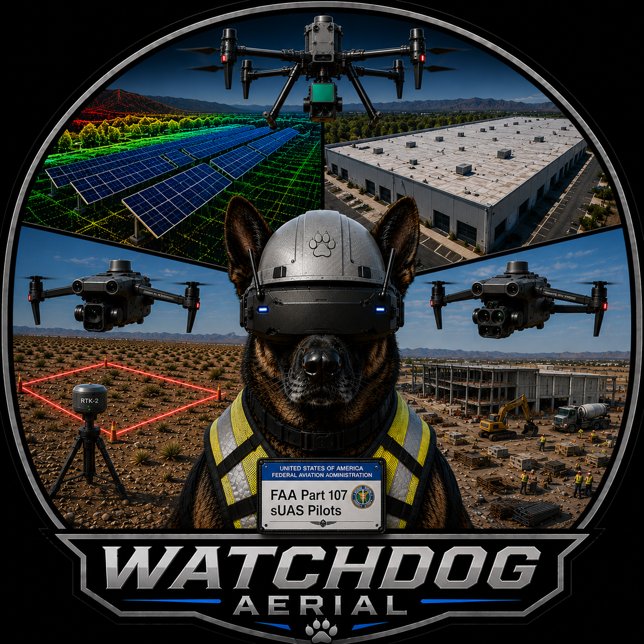
Eyes Above Every Job Site
Certified aerial documentation and monitoring for Las Vegas construction professionals, facility managers, and property owners.
FAA Part 107 Licensed | OSHA 30 Certified | NFPA 70E Certified | $2M GCL Insured
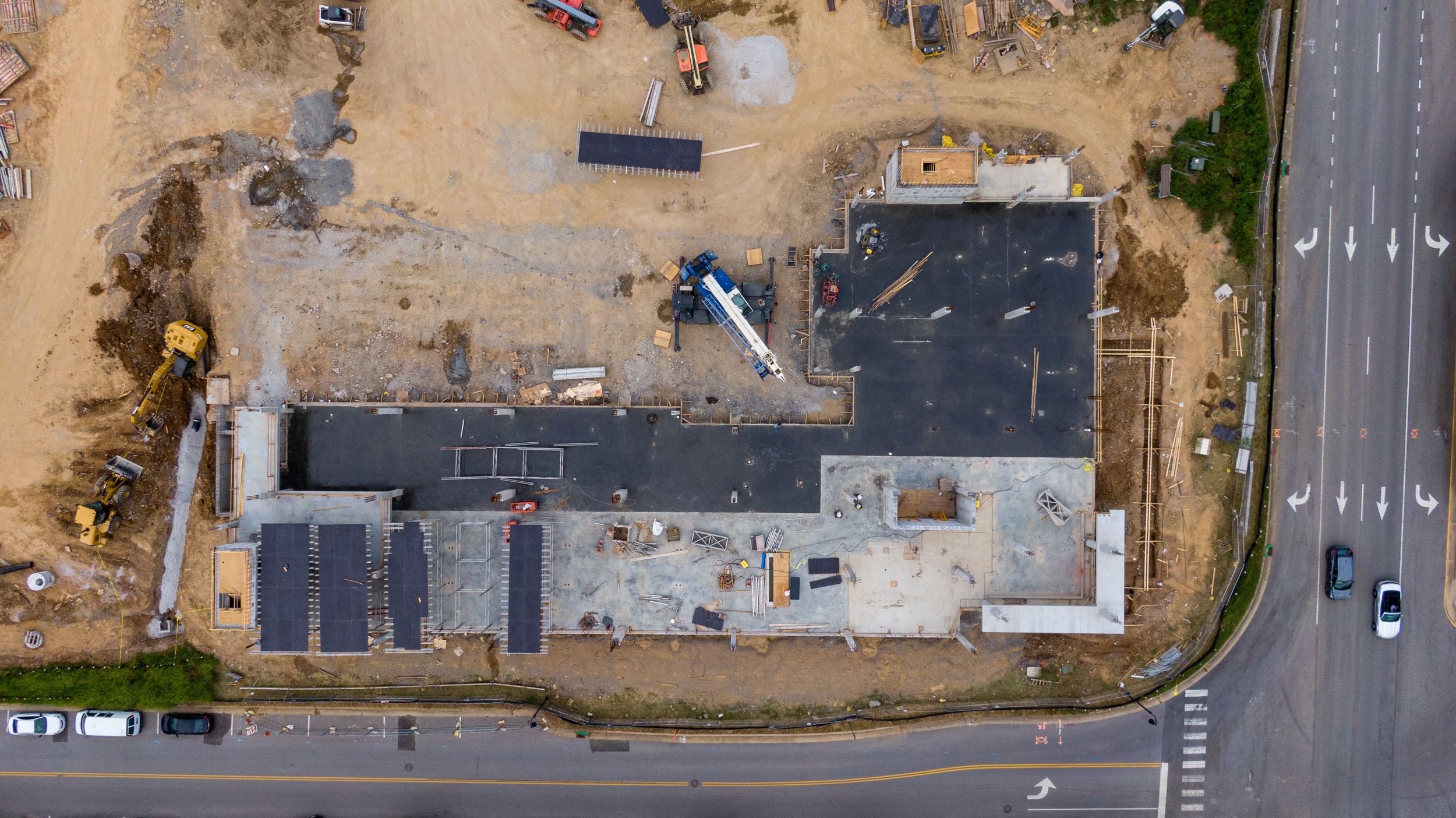
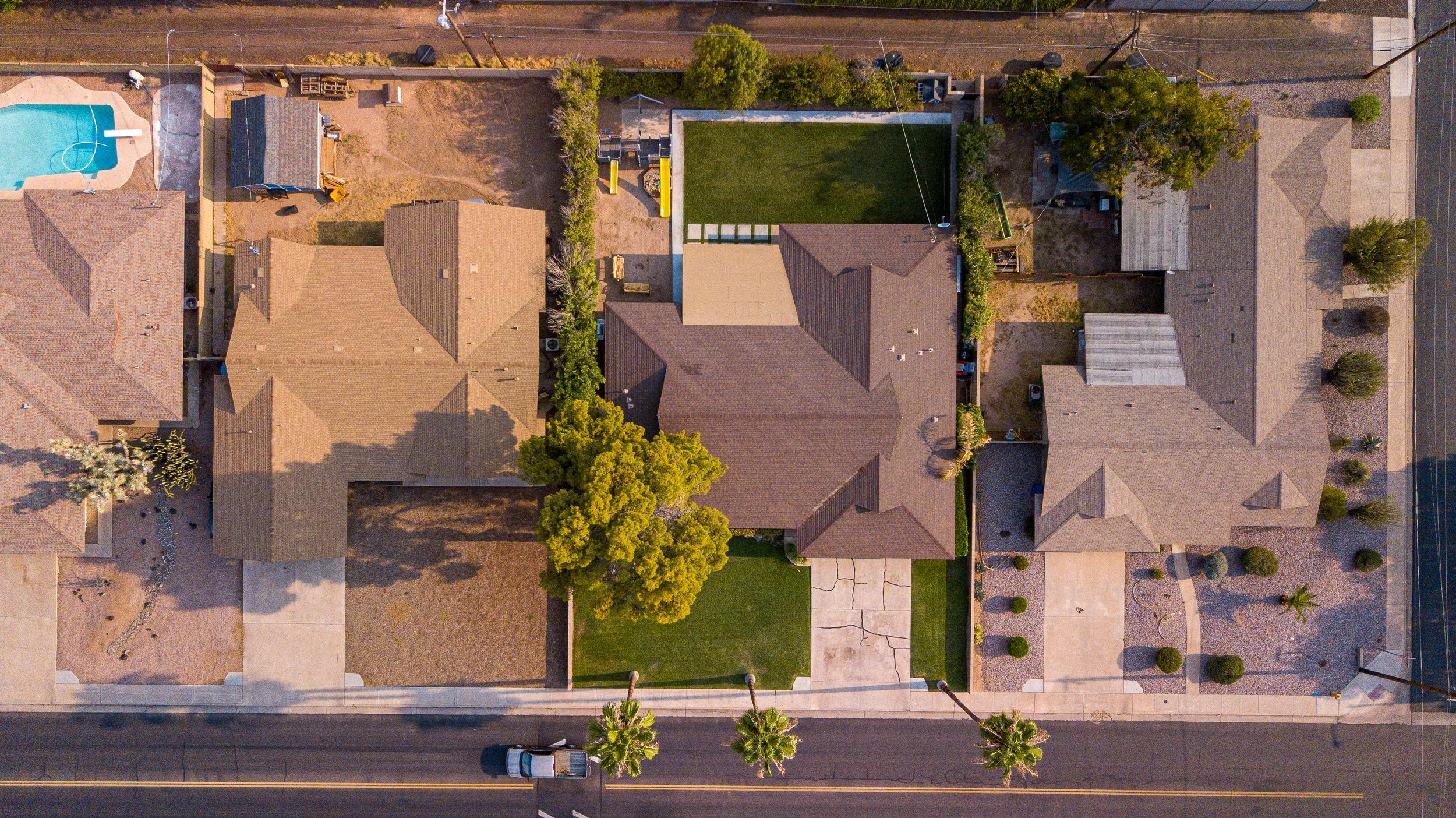
CONSTRUCTION PROGRESS TRACKING
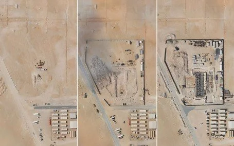
On a construction project, a single dispute can put you in the red. A missed milestone can trigger penalties. An uninformed owner becomes a problem owner. Watchdog Aerial solves all three.
Weekly drone flyovers give you GPS-stamped, date-verified aerial documentation of every phase of your project — showing exactly what was completed, when it was completed, and by whom.
When a subcontractor disputes their scope — you have proof. When an owner wants a progress update — you have it ready. When a milestone is approaching — you can see it coming from above.
Our OSHA 30 Construction certification means we meet jobsite safety requirements and can access active construction sites without interrupting your crew.
Deliverables include:
Weekly aerial progress photos, corners shots
Orthomosaic progress maps
4K video flyover, time lapse
Before and after comparisons
GPS and date stamped documentation
Delivered within 24 hours
Ideal for: General contractors, project owners, developers, and construction managers.
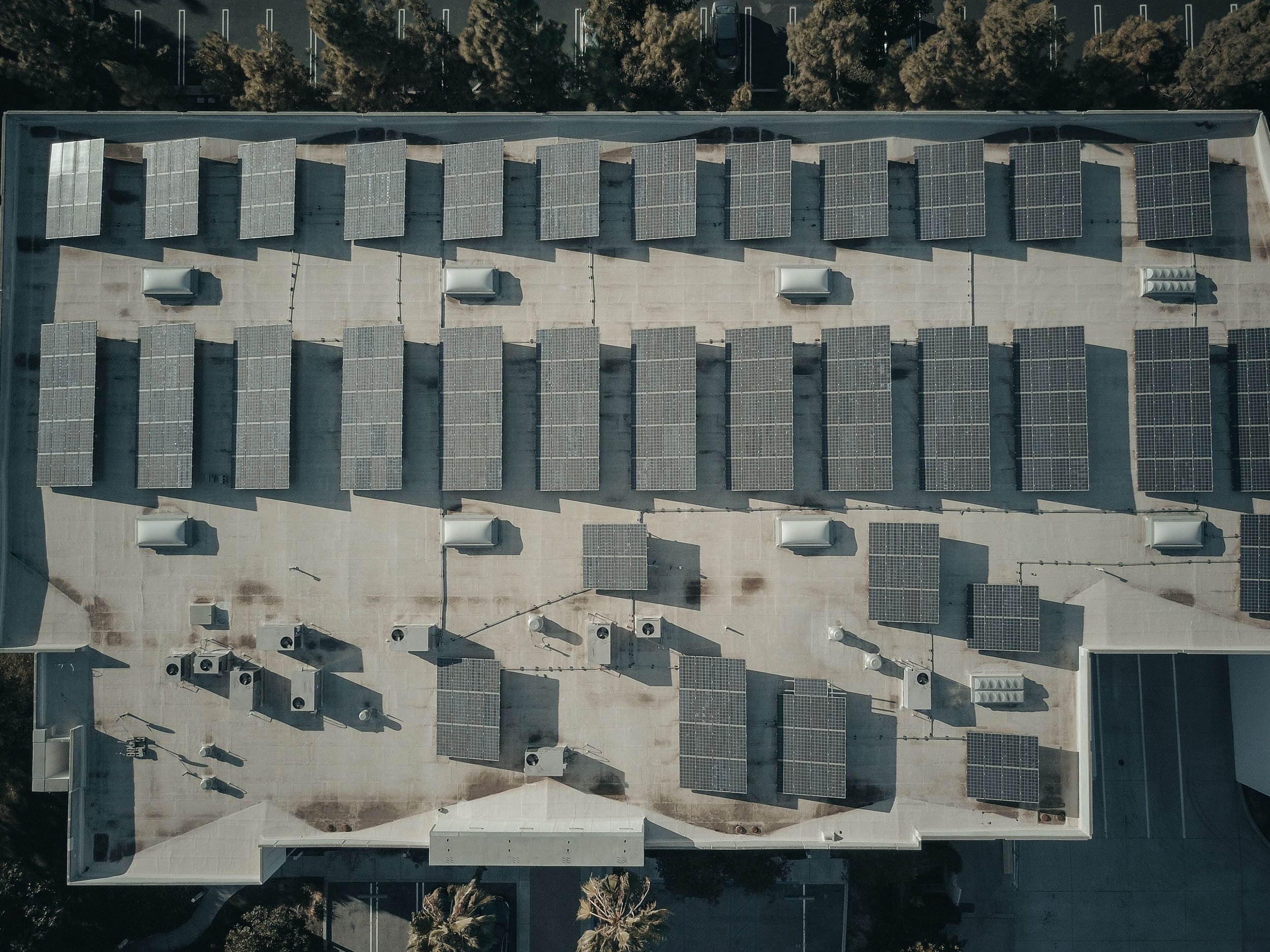
SOLAR INSTALLATION MONITORING
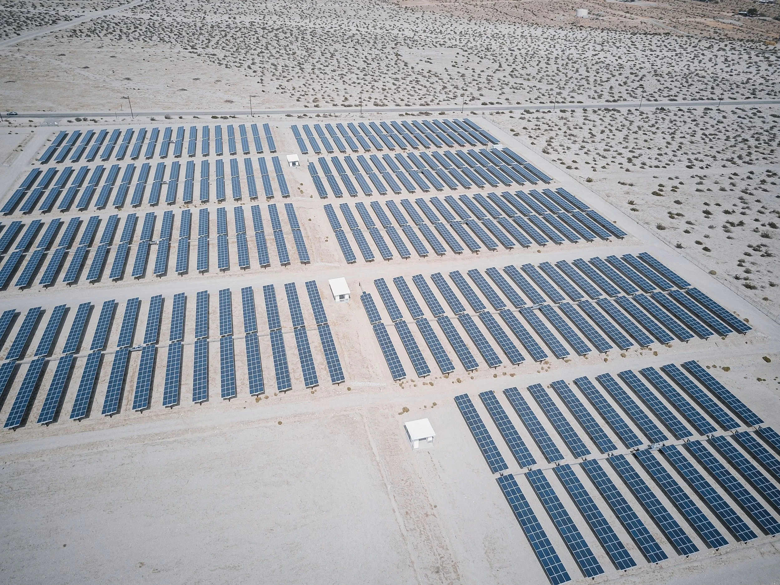
Protect your solar investment with monthly aerial documentation — catching problems before they affect your energy production and bottom line.
Most solar installations go unmonitored between scheduled maintenance visits. Panel damage, soiling accumulation, vegetation encroachment, and drainage issues can reduce energy output for weeks or months before anyone notices. By the time a ground crew identifies the problem — you've already lost thousands in reduced production.
Watchdog Aerial solves this with monthly aerial monitoring that gives you a complete overhead view of your entire installation — every panel, every row, every access road — delivered to your inbox.
Deliverables include:
Full orthomosaic overhead map of entire installation
High resolution photography — every section of your array
Month over month comparison images
Written condition summary
Identified issues with GPS location
Maintenance recommendations
Storm damage documentation when applicable
Delivered within 24 hours of flight
360° VIRTUAL SITE TOURS
Give project owners, investors, and stakeholders an immersive 360° walkthrough of your construction site, commercial facility, or property — accessible from anywhere in the world on any device. 360° virtual tours let viewers navigate through your space as if they were standing there in person — no site visit required.
Perfect for construction progress updates, pre-lease commercial property tours, facility documentation, and investor presentations.
Deliverables include:
Full 360° interactive virtual tour
Hosted online — shareable link
Viewable on any device including VR headsets
Individual 360° photos
Embedded navigation between multiple locations
Delivered within 24 hours
Ideal for: General contractors, developers, project owners, commercial property managers, investors, and facility managers.
ROOF & PROPERTY VISUAL INSPECTION
Document roof and property conditions safely and efficiently — without putting anyone on the roof!
Our drones capture detailed close-up imagery of shingles, flashing, gutters, HVAC units, skylights, and all roof penetrations from a safe aerial position — delivering a complete visual inspection report within 24 hours.
From residential roof assessments to large commercial flat roof surveys — we document everything your team needs to assess condition, plan repairs, or support insurance claims.
Deliverables include:
Full roof orthomosaic overhead map
Horizontal and vertical facade inspection
Close-up detailed shots
HVAC and penetration documentation
4K video flyover
Written condition summary report
PDF inspection report with branding
Ideal for: Roofing contractors, property managers, insurance adjusters, facility managers, and real estate agents.
VACANT LAND MONITORING
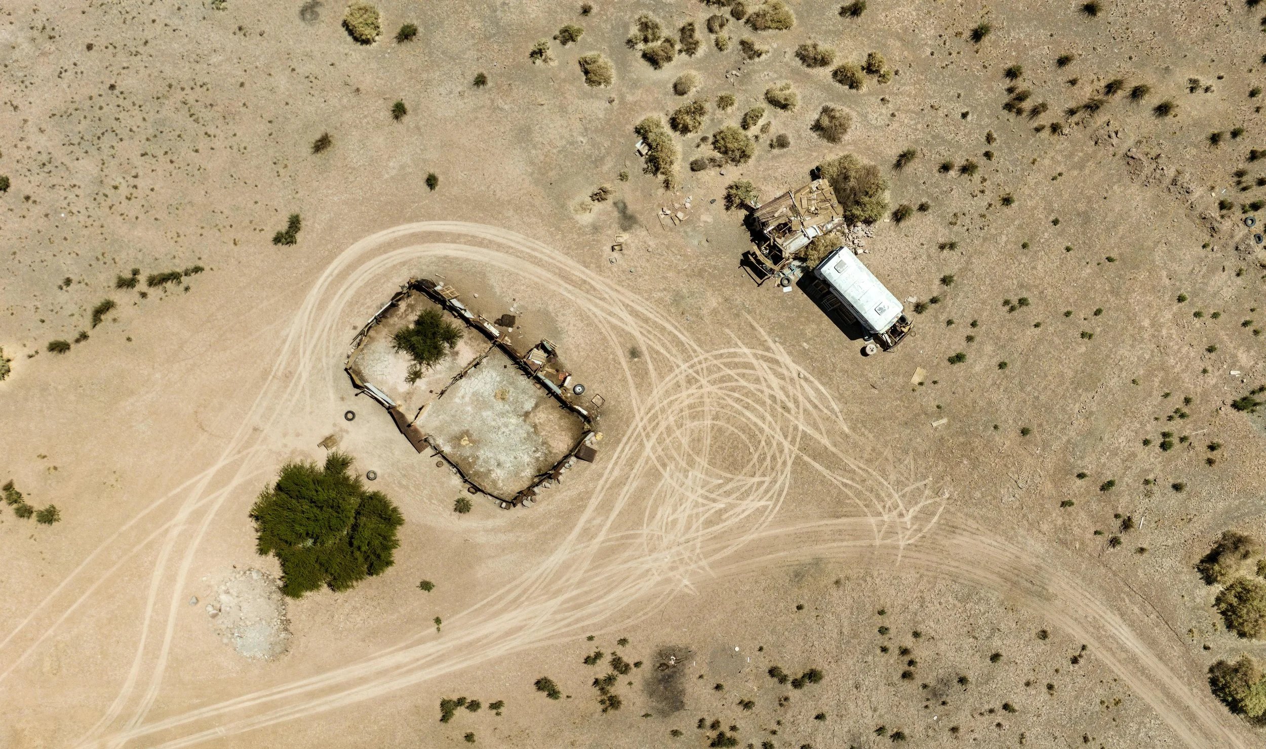
Own vacant land in Las Vegas but can't be there to check on it? Watchdog Aerial provides monthly drone flyovers of your vacant property — delivering 4K aerial photos, video, and an overhead map directly to your inbox every month so you always know the condition of your land.
We document illegal dumping, encampments, trespassing, boundary conditions, and code violations — giving you dated GPS-stamped evidence for code enforcement complaints, insurance claims, or legal proceedings if needed.
Monthly report includes:
4K aerial video flyover
High resolution overhead photos
Complete boundary documentation
Written condition summary
Comparison to previous month
Delivered within 24 hours of flight
Ideal for: Out of state investors, land developers, HOA management companies, Commercial Real Estate Agents, and commercial property owners.
COMMERCIAL AERIAL PHOTO & VIDEO
Professional 4K aerial photography and video for commercial properties, industrial facilities, construction projects, and special events.
Our drones delivers cinema-quality aerial imagery that showcases your property, project, or facility from perspectives impossible to achieve from the ground — giving you compelling visual content for marketing, presentations, and documentation.
Deliverables include:
4K aerial video footage
High resolution aerial photography
Edited highlight reel
Raw footage delivered on request
Delivered within 24 hours
Ideal for: Commercial property owners, developers, marketing teams, architects, and facility managers.
PHOTOGRAMMETRY & AERIAL MAPPING
Transform aerial imagery into accurate 2D maps and 3D models of your site — delivering professional geospatial data for construction planning, site documentation, and progress monitoring.
Using industry-leading processing software we convert drone imagery into detailed orthomosaic maps, 3D mesh models, digital elevation models, and point clouds — giving your team actionable data from every flight.
All mapping deliverables include a clear accuracy statement. Mapping data is intended for progress monitoring and documentation purposes and is not a certified survey.
Deliverables include:
2D orthomosaic map — GeoTIFF format
3D mesh model
Digital elevation model (DEM)
Point cloud data
Quality report
GPS accuracy ±1-3 meters standard
Ground control point service available for improved accuracy
Ideal for: General contractors, developers, surveyors, engineers, and site managers.
INSURANCE & DAMAGE DOCUMENTATION
Fast professional aerial documentation for insurance claims, pre and post construction condition records, and property damage assessment.
We provide dated GPS-stamped aerial photography and video that creates an irrefutable visual record of property condition — supporting insurance claims, protecting against disputes, and accelerating the claims process.
Deliverables include:
High resolution condition photography
4K video documentation
GPS and date stamped imagery
Written condition summary
PDF documentation report
Rush delivery available
Ideal for: Insurance adjusters, property managers, contractors, and property owners.
CELL TOWER & TELECOM DOCUMENTATION
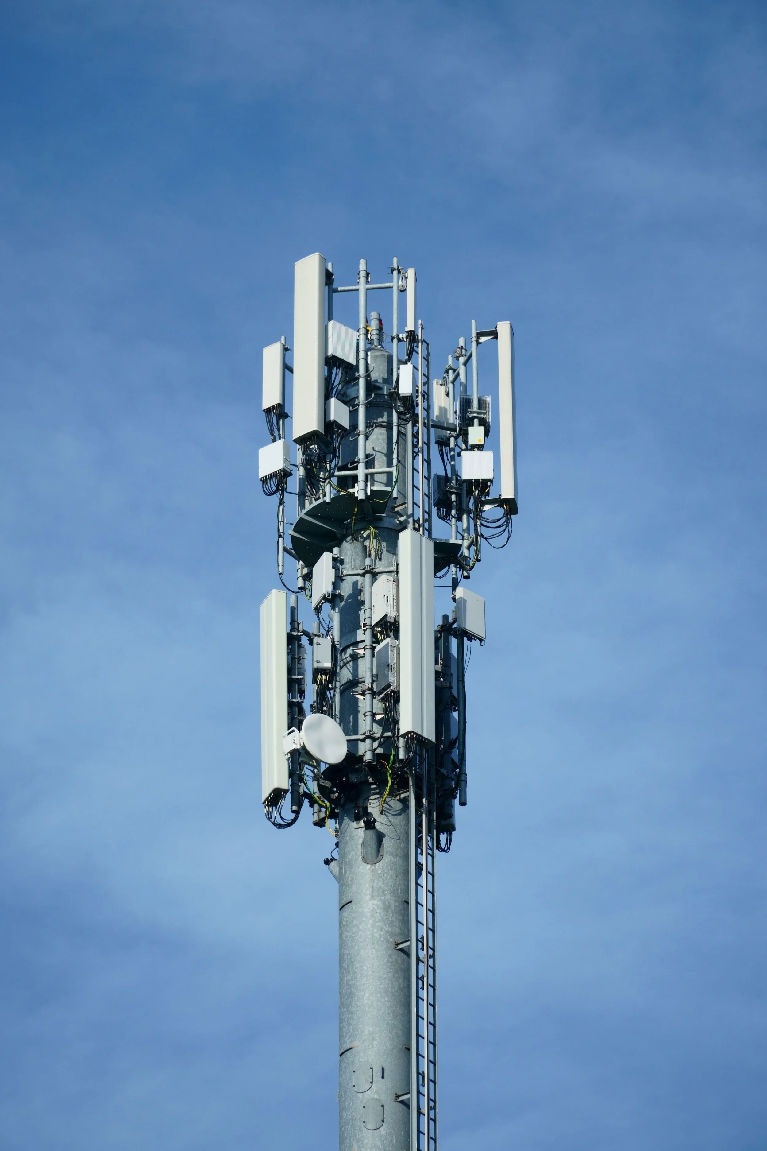
Professional aerial documentation of cell towers, antenna arrays, and telecom infrastructure — delivered by a certified pilot who understands RF environments and telecom site requirements.
Our drone zoom capability allows detailed close-up documentation of antenna positions, mounting hardware, and structural conditions from a safe aerial position — eliminating the need for tower climbers for initial visual assessment.
Deliverables include:
Full tower aerial documentation
Close-up antenna position photos
Structural condition overview
4K video documentation
Written condition report
Delivered within 24 hours
Ideal for: Tower management companies, telecom contractors, and wireless carriers.
Ready To Put Watchdog Aerial To Work?
All services include:
✅ FAA Part 107 certified pilot
✅ OSHA 30 construction site compliant
✅ NFPA 70E electrical safety certified
✅ $2M commercial liability insurance
✅ Certificate of insurance on request
✅ Additional insured endorsements available
✅ 24 hour delivery guaranteed
✅ Las Vegas, Henderson, North Las Vegas, Clark County, and Surrounding Areas